
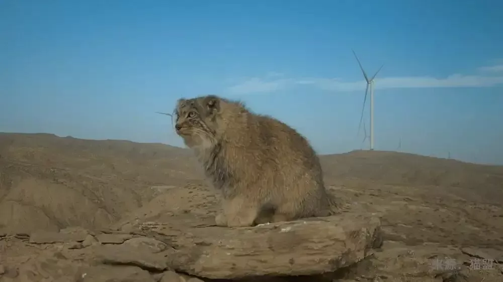
An environmental report declared a wind farm site empty. Infrared cameras found endangered Pallas’s cats
An environmental impact assessment for a wind power project in the Bailongling desert of Zhangye, Gansu province, explicitly stated that “no protected species are distributed” in the area. Contradicting this official paperwork, however, infrared trail cameras set up by the Chongqing-based Shanshui Conservation Center and its partners—specifically the China Felid Conservation Alliance (CFCA)—consistently captured the active traces of the Pallas’s cat, a state-class-two protected wild animal, throughout a 12-month monitoring cycle.
An assessment report claims emptiness, while field monitoring reveals frequent sightings. This glaring cognitive gap lays bare deep flaws and insufficient field investigations regarding wild species and vegetation resources that many development projects rely on during ecological impact assessments.
Infrared monitoring equipment records the activity of a Pallas’s cat in the desert of northern Zhangye.
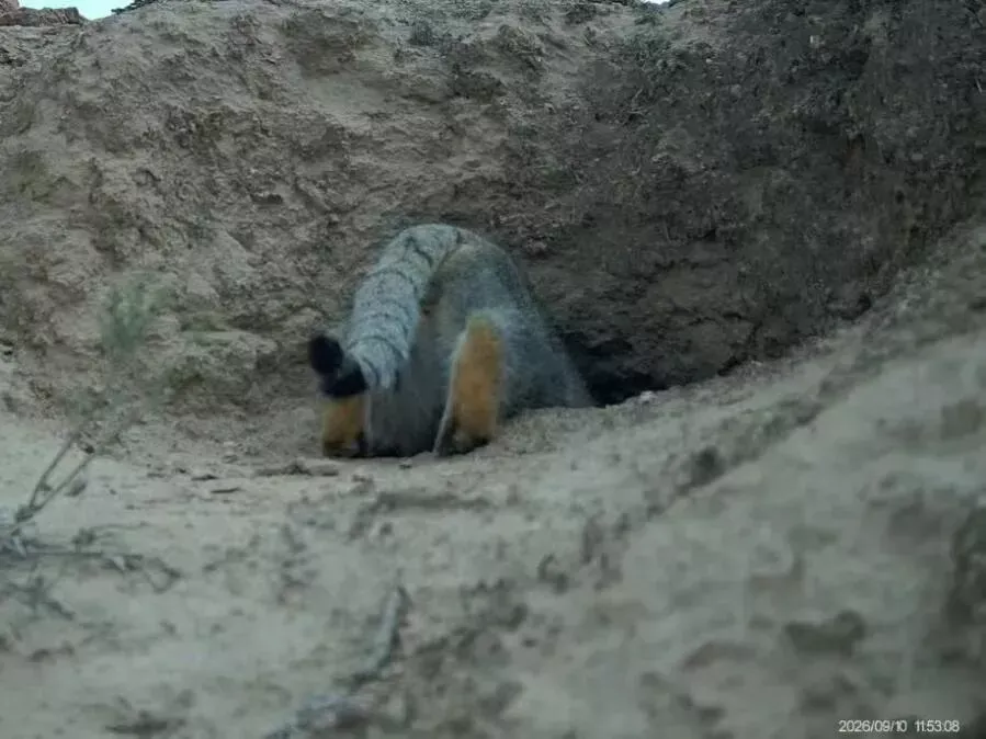
Monitoring footage of the species in the Bailongling desert this September. (Source: CFCA)
It must be candidly pointed out that China still has room to deepen its understanding of the basic conditions of wild species and vegetation resources on a nationwide scale. The phenomenon in Zhangye is merely a microcosm of this nationwide dilemma, driven by multi-layered and multi-faceted causes.
From a historical perspective, China has long lacked systematic and continuous nationwide coverage in baseline surveys of biodiversity resources. Early accumulated biodiversity survey results also face issues of outdated data and fragmented distribution. It was not until the State Council completed its institutional reform in 2018 that China established a new territorial spatial planning framework featuring “multi-planning integration,” allowing biodiversity baseline surveys to expand from experimental local efforts to detailed national surveys and comprehensive assessments.
By the time Zhangye’s current territorial planning scheme was approved in 2024, numerous baseline data points remained blank, and the region’s next round of national protection and endangered plant resource surveys is not scheduled to begin until 2025. Coupled with multiple constraints such as personnel, funding, and technology, comprehensive regional surveys cannot be accomplished overnight. In addition, as investigation and monitoring continue to deepen and new discoveries emerge, the five-year periodic review cycle of territorial plans has also caused data updates to lag behind. In short, the phrase “no protected animals” appearing in environmental impact assessment documents is merely a transitional product while data supplementation work is still underway.
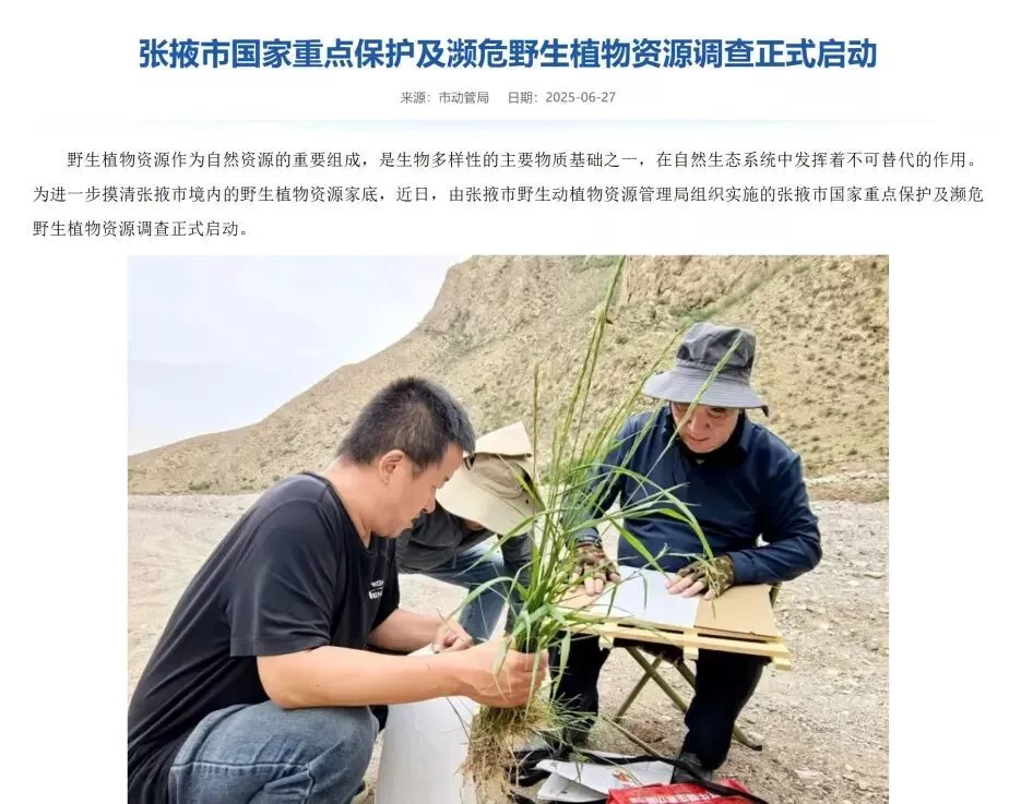
Information excerpted from the Zhangye Municipal People’s Government website.
However, it must be made clear that “blanks” regarding wildlife information in planning materials by no means signify that the ecology of Zhangye’s desert is actually a “blank.” Corporate promises and plans for ecological restoration and improvement can never be built on a foundation of missing baseline information. In addition to the repeated appearances of Pallas’s cats on monitoring lenses, social research institutions in recent years have also recorded state-protected wild species in this region, including goitered gazelles, wolves, black storks, and golden eagles. Although these animals cannot speak, their active image data silently and powerfully proves that they do inhabit the area, delivering the most direct and forceful challenge to the EIA conclusion of “no protected animals.”
It is worth noting that relevant regulations and policies have issued warnings long ago: according to the Zhangye Territorial Spatial Master Plan (2021–2035), the wind power project is located in a critical ecological functional zone. The principle of prioritizing ecological protection must be strictly implemented, and strict restrictions must be imposed on the scale and scope of development. Therefore, when the administrative EIA process has been completed yet obvious loopholes are exposed in reality, the EIA work should embrace public supervision, uphold the authority of scientific facts, and promptly adjust and correct policy orientations after problems are exposed. This is the top priority at present.
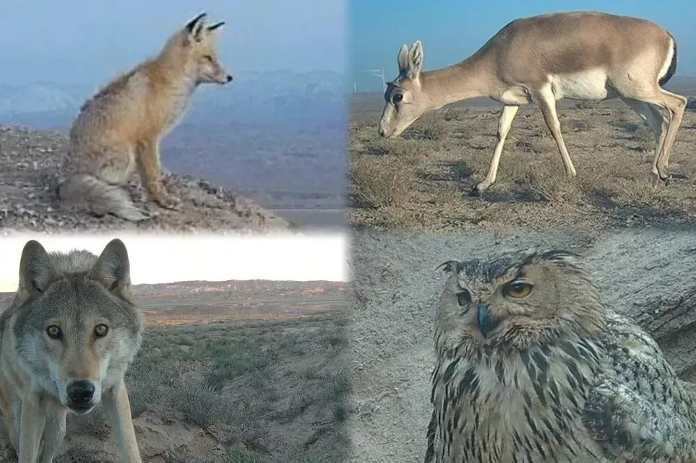
A variety of state-class-two protected wild animals recorded by infrared equipment in Bailongling, including red foxes, goitered gazelles, wolves, and Eurasian eagle-owls. (Source: CFCA)
From a long-term and fundamental perspective, the construction of regional biodiversity baseline data systems should be strengthened and improved. To this end, government departments need to establish regional biodiversity baseline databases and open up channels for mutual communication among official survey results, research data from academic institutions, and monitoring records from non-governmental organizations. As baseline surveys and assessments of wild species and vegetation resources are progressively advanced, important wildlife habitats should be promptly identified and protected, incorporated into regional development and construction site selection references, and protected through avoidance and other measures in accordance with laws and regulations.
Enterprises should conscientiously fulfill their responsibilities and obligations in ecological environmental protection and social governance, support research departments and conservation organizations in conducting baseline surveys, and exercise prudent consideration in site selection decisions within ecologically fragile and sensitive areas. If key habitats of state-protected animals are destroyed as a result, they will inevitably bear corresponding legal consequences.
EIA professional institutions should make investigation and assessment work more solid and rigorous. When encountering insufficient basic materials or doubtful distributions of key protected animals, they should seek assistance from qualified institutions for investigation, avoiding the worst practice of issuing conclusions based on subjective judgments without leaving their offices. Grassroots research institutions and scientific research units should also actively communicate and feed back data with local forestry and environmental protection departments, promoting the inclusion of years of accumulated monitoring information into policy-making considerations, and truly transforming persistent fieldwork into sustainable ecological development practices.
Only when all parties form a joint force and consensus can baseline data gradually move from fuzzy to clear, and can EIA work become true and accurate without deviating from facts.

Illustrations of species such as Pallas’s cats, red foxes, and goitered gazelles. (Illustrated by Travel Jay)
Wild animals like the Pallas’s cat are extremely sensitive and responsive to changes in surrounding ecological conditions. While industry baseline databases can continue to be optimized and improved in the future, once the ecological environment shared by humans and wildlife is destroyed, the loss will be irreversible. Only by genuinely respecting scientific evidence and timely integrating the latest monitoring and survey discoveries into the entire process and chain of policy decision-making can project EIAs withstand the technical test of infrared cameras, allowing green development and ecological protection to coexist harmoniously on the same land.